Multisensor-Drone-Image Fusion
Multisensor-Drone-Image Fusion (MDI) Research Group
Description of Activities
Supporting the establishment of sensitive spatial data assets for national security through the development of a high-resolution, multi-sensor technology based remote sensing method and knowledge hub. We are not creating a spatial data repository but rather working on the usability and applicability of platform technologies based on methodological, geo-visualization, and scientific perspectives. Such sources are not currently available in Hungary, making our research of significant market interest. Practical examples of using our results include tracking surface changes, volumetric indicators (e.g., vegetation, railways, highways, airports), and monitoring vulnerable or critical objects (e.g., infrastructures, border crossings, rockslides) using satellite or drone-based sensors. Hydrological processes, vegetation indicators, air pollution, fires, floods, and water quality hazards and more can also be examined using spectral and optical sensors. Understanding the spatial, temporal, and thematic resolution of spatial data can significantly reduce the occurrence of adverse events.
Research Interests
The research activity described above involves the following tasks:
- Research focused on improving high-resolution remote sensing technologies to capture detailed spatial data for various applications.
- Exploring the integration of multiple sensors (e.g., satellite, drone, and other sensors) to enhance data collection and analysis capabilities.
- Developing new methodologies for the analysis of geospatial data, especially concerning spatial, temporal, and thematic resolutions.
- Investigating techniques and tools for visualizing spatial data effectively, making it accessible and interpretable for various user groups.
- Research into how spatial data can be utilized to enhance national security, including monitoring critical infrastructure, border crossings, and other security-sensitive locations.
- Studying the application of remote sensing data for monitoring environmental factors such as hydrological processes, vegetation changes, air quality, and more.
- Research on using spatial data to predict and manage disasters, including natural events like floods, wildfires, and landslides.
- Monitoring and managing infrastructure assets such as railways, highways, airports, and other critical facilities using spatial data.
Research/service concepts/Methodology
Techniques for fusing and integrating data from multiple sensors to create comprehensive and accurate spatial datasets. Machine learning and artificial intelligence algorithms for automated data processing, feature extraction, and pattern recognition in large spatial datasets. Geospatial analysis techniques, including spatial statistics and modeling, to extract valuable insights from spatial data. Image processing algorithms to enhance the quality and interpretability of remote sensing imagery. Robust security and privacy measures to protect sensitive spatial data, especially in the context of national security. Market research to understand the demand for spatial data solutions and formulate business strategies for commercialization. Collaboration with other research institutions, government agencies, and industry partners to leverage expertise and resources. Offering training programs and educational initiatives to build expertise in spatial data technology among researchers, professionals, and decision-makers.
Research Staff
- Dr. András Jung, Associate Professor, Head of group
- Dr. Béla Kovács, Associate Professor, Senior researcher
- Dr. Gáspár Albert, Associate Professor, Senior researcher
- Dr. Zsófia Varga, Assistant Professor, Senior researcher
- Dr. Márton Pál, Assistant Professor, Junior researcher
- Dr. Fanni Vörös, Assistant Professor, Junior researcher
- Edina Hajdú, PhD student
- MSc and BSc students involved in short projects
Projects
The research group is involved in the following project as Multisensor-Drone-Image Fusion research group: 2022-2025, pillar 2 in the project no. TKP2021-NVA “Thematic Excellence Programme 2021 l National Defence, National Security Subprogramme”)
5 important publications in the field
- Vörös, F., Gartner, G., Peterson, M. P. and Kovács, B. (2023) ‘Do Social Aspects Affect Built-in Car Navigation Habits? A Stereotype Study’, Sustainability, 15(6), pp. 5203:1–5203:23. https://doi.org/10.3390/su15065203
- Vörös, F., van Wyk de Vries, B., Guilbaud, M. N., Görüm, T., Karátson, D. and Székely, B. (2022) ‘DTM-Based Comparative Geomorphometric Analysis of Four Scoria Cone Areas—Suggestions for Additional Approaches’, Remote Sensing, 14(23), pp. 6152:1–6152:22. https://doi.org/10.3390/rs14236152
- Varga, Z., Vörös, F., Pál, M., Kovács, B., Jung, A. and Elek, I. (2022) ‘Performance and Accuracy Comparisons of Classification Methods and Perspective Solutions for UAV-Based Near-Real-Time “Out of the Lab” Data Processing’, Sensors, 22(22), pp. 8629:1–8629:14. https://doi.org/10.3390/s22228629
- Lausch, A., Schaepman, M. E., Skidmore, A. K., Catana, E., Bannehr, L., Bastian, O., Borg, E., Bumberger, J., Dietrich, P., Glässer, C., Hacker, J. M., Höfer, R., Jagdhuber, T., Jany, S., Jung, A., Karnieli, A., Klenke, R., Kirsten, T., Ködel, U., Kresse, W., Mallast, U., Montzka, C., Möller, M., Mollenhauer, H., Pause, M., Rahman, M., Schrodt, F., Schmullius, C., Schütze, C., Selsam, P., Syrbe, R-U. Truckenbrodt, S., Vohland, M., Volk, M., Wellmann, T., Zacharias, S., and Baatz, R. (2022) ‘Remote sensing of geomorphodiversity linked to biodiversity—part III: traits, processes and remote sensing characteristics’, Remote Sensing, 14(9), pp. 2279:1–2279:48. https://doi.org/10.3390/rs14092279
- Márta, A., Jung, A. and Molnár, B. (2022) ‘Information Technology Drivers in Smart Farming Management Systems. In Danish, S., Ali, H. and Datta R. (eds) Smart Farming - Integrating Conservation Agriculture, Information Technology, and Advanced Techniques for Sustainable Crop Production, IntechOpen. https://www.intechopen.com/chapters/83785
Infrastructure
High-performance field laptop
Stonex S9III (geodesy GPS)
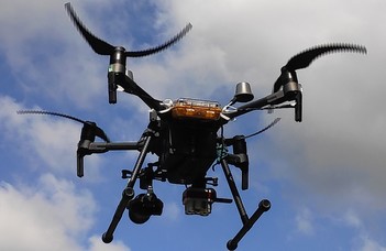
UAVs:
DJI Matrice 210 v2 RTK
DJI Matrice 350 RTK – 2023
Sensors:
DJI Zenmuse X5s RGB sensor
Micasense Altum multispectral camera
DJI Zenmuse P1 RGB sensor
DJI Zenmuse L1 LiDAR – 2023
DJI Zenmuse H20T RGB+thermal sensor
Cubert ULTRIS 5 hyperspectral camera
